Collaboration

Partnerships for research, development, and technology transfer – from collaborative projects to tailored innovation solutions.

About SAL

Insights into SAL’s mission, values, research activities, and contribution to Europe’s innovation ecosystem.

AGROSEISMOLOGY

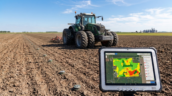
Develop a low-cost acoustic seismic sensor network and inversion software for non-invasive mapping of soil compaction and moisture in agricultural fields.

Objectives

The objective is to develop and validate a seismic sensing platform that determines the mechanical state of agricultural soil, its compaction, bulk density and pore connectivity, without excavation, drilling or sampling, as well as its water content.

Soil compaction affects an estimated 23 to 29 % of European agricultural subsoils, with modelled annual losses of some € 7 billion in crop yield and further losses in carbon and nitrogen services. Wheel loads on European field machinery have increased by almost 600 % since 1960. Compaction is still assessed destructively, point by point, with a penetrometer and a spade.

Established sensors do not resolve this. Capacitance and TDR probes sample a few cubic centimetres per depth layer. Electrical resistivity and electromagnetic induction respond primarily to soil moisture, which masks the compaction signal. Satellite remote sensing reaches the uppermost centimetres and provides no structural information.

Seismic methods address the property directly. In unsaturated soil, elastic wave velocity is determined by skeleton stiffness, effective stress and aggregate contact area, which is the physical definition of compaction. A compaction event remains detectable in the seismic signature five years later, and distributed acoustic sensing resolves infiltration and evapotranspiration at minute resolution. While the physics is well established, the open problem is instrumentation that is robust, calibrated and affordable enough for field use.

Expected Results 

  • Functional demonstrator of a low-cost, wireless, time-synchronised acoustic seismic node and multi-node field array.
  • Characterized and documented sensor–soil coupling and cross-sensitivity behavior, including accelerated ageing and field robustness testing.
  • Inversion and data-fusion software producing 2D/3D maps of soil compaction and moisture from field array data.
  • Quantified performance benchmark against reference seismic instrumentation and against conventional destructive soil measurement.

Contact

Business Development
Mag. Veneta Ivanova
Business Development Sensor Systems
Villach

Newsletter

Our Science & Stories newsletter provides the latest news, bietet aktuelle Neuigkeiten, Forschungshighlights und spannende Einblicke
von Silicon Austria Labs – direkt ins Postfach.